
Status
Complete
Network
Habitat
Living on the Banks of the Garnock
This project delivered practical methods to address diffuse pollution and invasive species on farmland within the Garnock catchment, which now benefit from green engineering techniques providing multiple benefits to the landowner, watercourse and local biodiversity.
GIS mapping at the catchment level illustrated the risks of spreading manures and slurry (RAMS) provided over 50 Garnock land managers with the knowledge on where to spread farm waste responsibly. RAMS is advocated as a means of reducing pollution thus protecting watercourses and their associated wildlife (Scottish Government’s 4 Point Plan).
Mapping riparian networks identifies where habitat creation optimises connectivity and provides a baseline to measure the success of landscape scale initiatives.
Priority areas were identified from SRUC RAMS catchment map, riparian woodland networks map, outcomes from SEPA’s priority catchment walks and ART’s River Garnock 2005 habitat survey report. Demonstrations sites were established within the catchment to exhibit how to reduce pollution and receive multiple benefits via a range of green engineering techniques (e.g. willow weaving, willow fencing, brash bundle installation and tree planting). These relatively simple techniques are cost effective to maintain and provide multiple benefits to landowners, watercourses and local biodiversity. They stabilize eroding banks by sediment deposition, reduce diffuse pollution, increase terrestrial and aquatic biodiversity, increase the sustainability of agricultural production and mitigate against climate change impacts through reducing fluctuations in water temperature and flow.
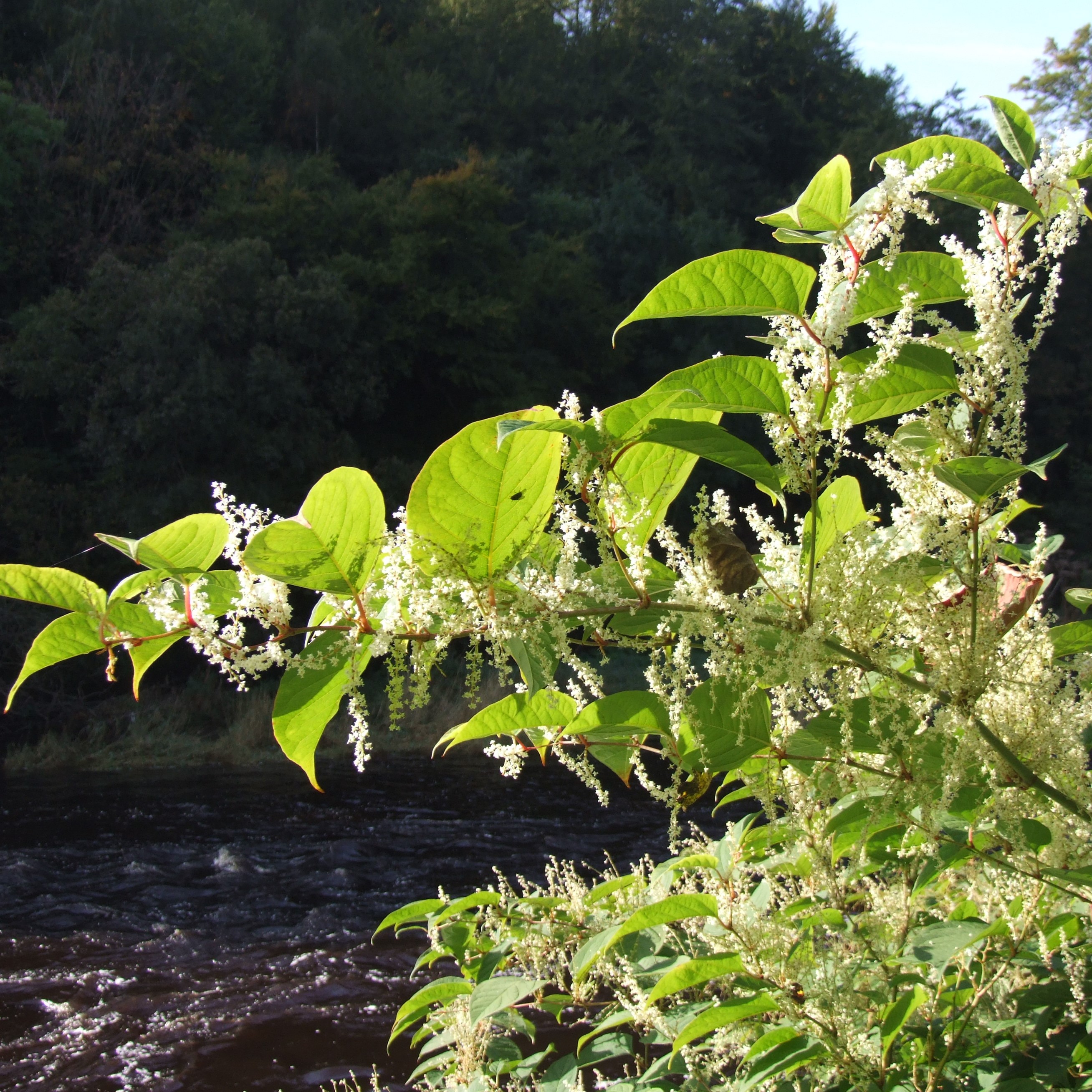
Invasive non-native plant species (INNPS) continue to plague the River Garnock and its tributaries. This project incorporated upskilling local volunteers to control INNPS across the River Garnock catchment including giant hogweed, Japanese knotweed and Himalayan balsam. This part of the project relied on both skilled and unskilled volunteers to control INNPS throughout the catchment.

Outputs achieved
8 volunteers trained & 53 landowners engaged
200 trees planted to stabilise banks
1,050m of habitat improvement
6 demonstration sites
1 riparian habitat network map created
1 multiple engineering tech case study completed
3 Invasive Non Native Species controlled

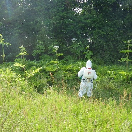

Spraying Giant Hogweed
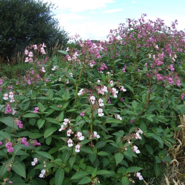
Himalayan Balsam
Japanese Knotweed
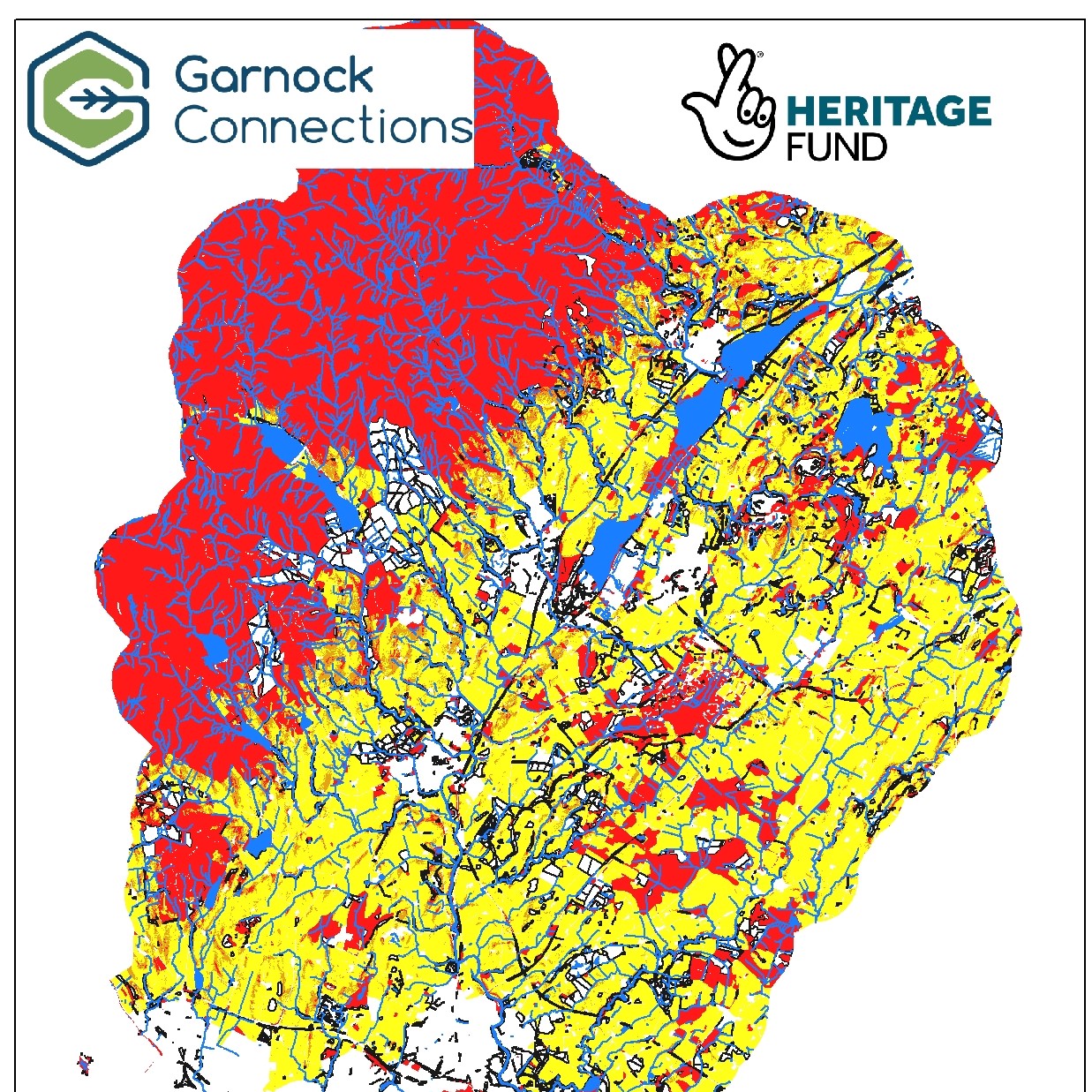
A RAMS map showing high-risk pollution areas
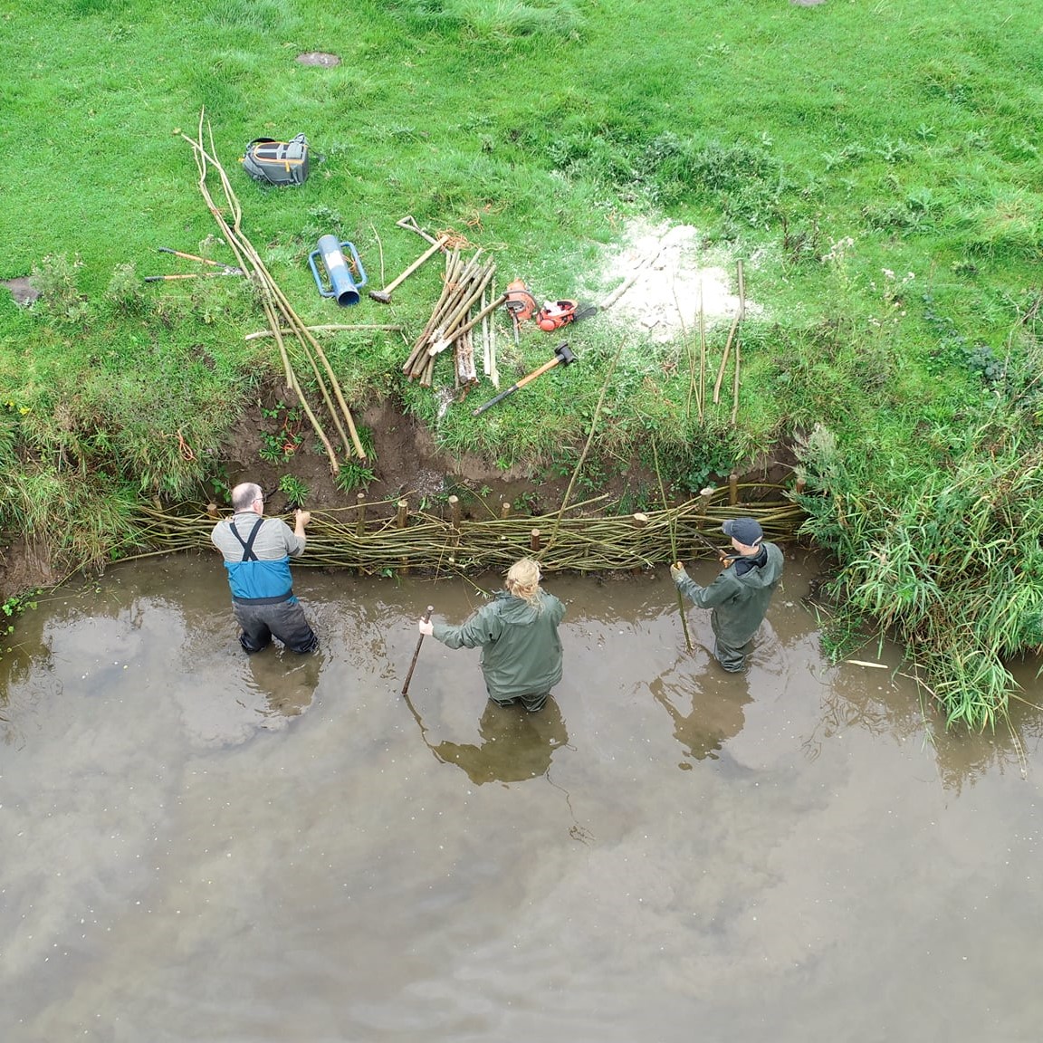
Willow spiling to help stabilise riverbank

Brash bundles - green engineering technique
Did you know?
Once green bank engineering is established it not only stabilises the river bank, but gives benefits to plants, invertebrates, birds and animals which live in the riparian area. Green engineering improves in-channel habitats for all aquatic species, reduces erosion, and traps sediment from within the watercourse.